Saba is one of the best hiking destinations in the Caribbean. Nearly all the hiking trails do a wonderful job at fulfilling the promise of an unforgettable view thanks to the island’s steep hills.
Despite being only five square miles, there are nearly 20 trails to choose from. You can wander through a dry scrub vegetation, a dry tropical forest, a lush tropical rainforest, and a dreamy cloud forest on the same day.
The hiking trails on Saba are part of its history: they were the only connection between the island villages up to the mid-20th century before the construction of The Road.
I hiked all the trails I list here and I can attest that Saba is a hiker’s paradise.
Disclosure: This post contains some affiliate links. If you make a purchase through those links I will earn a commission at no additional cost to you (zero, nada). To check the full disclaimer, click here.
This is your guide to the hiking trails on Saba island, listed by level of difficulty.
HIKING TRAILS ON SABA WITH HIKING DIFFICULTY: EASY
Table of Contents
Flat Point Loop (Tide Pools)

The barren landscape of Flat Point is a great location to watch seabirds, with many Magnificent Frigatebirds and Brown Booby birds flying around, and the silhouette of Old Booby Hill and St Eustatius in the background.

In the first section of the trail you’ll walk on a grassy meadow where you’ll see the ruins of an old indigo boiling house.


Once you reach the fork, the landscape switches to reddish gray heaps of solidified lava that made me feel as if I landed on a strange planet. But no, it’s the spills of the dormant volcano where Saba exists.
The spikey lava rocks are home to a few cacti. Follow the orange-yellow marks and make your way down the steep, rough terrain to get close to the tide pools. You’ll do much better wearing sport sandals rather than flip flops.
Depending on the temperament of the sea you can find a shallow, rather flat pool that will allow you to get a little closer and spot marine life. I saw brain coral, lesser starlet coral, sea urchins, sea anemones, hydroids, Striped Parrotfish (juvenile), Fuzzy Chitons and Sergeant Majors.


Or, you can find big waves crashing and a dangerous riptide, in which case it’s better to enjoy the show sitting from a safe distance and find odd shapes in the lava formations.
Let’s remember that corals are fragile animals and touching them or standing on them may kill them. Once they’re gone, so are the fish.
To visit Flat Point and the Tide Pools take the road to the airport and keep driving down a few feet until you see the trailhead sign on the left (before you reach Cove Bay).
Distance: 0.58 kms/0.36 miles
Estimated time: 30 minutes
Dancing Place Trail

This short trail offers an easy way to enjoy a bird’s eye view of the hills on the south side of Saba. Way easier than tackling the Giles Quarter Trail, which you can access from this trail, to go down to the coast.

The Dancing Place trail runs parallel to a short section of The Road (Saba’s main road) between Windwardside and St. John’s. You’ll see the you-blink-you-miss-it trailhead sign on the steps leading down to the trail, next to the “Welcome to Windwardside” sign.
Distance: 0.4 kms/0.25 miles
Estimated time: 20 minutes one way
Mas’Cohone’s Trail

The Mas’Cohone’s Trail shares the trailhead and most of its route with the lower section of the Mount Scenery trail, until you reach a sign on the left indicating the short path towards the viewpoint.
Before that sign, the uphill trail consists of uneven stairs shaded by a dense forest (it will be slippery with rain) and a few sections with a dirt path.
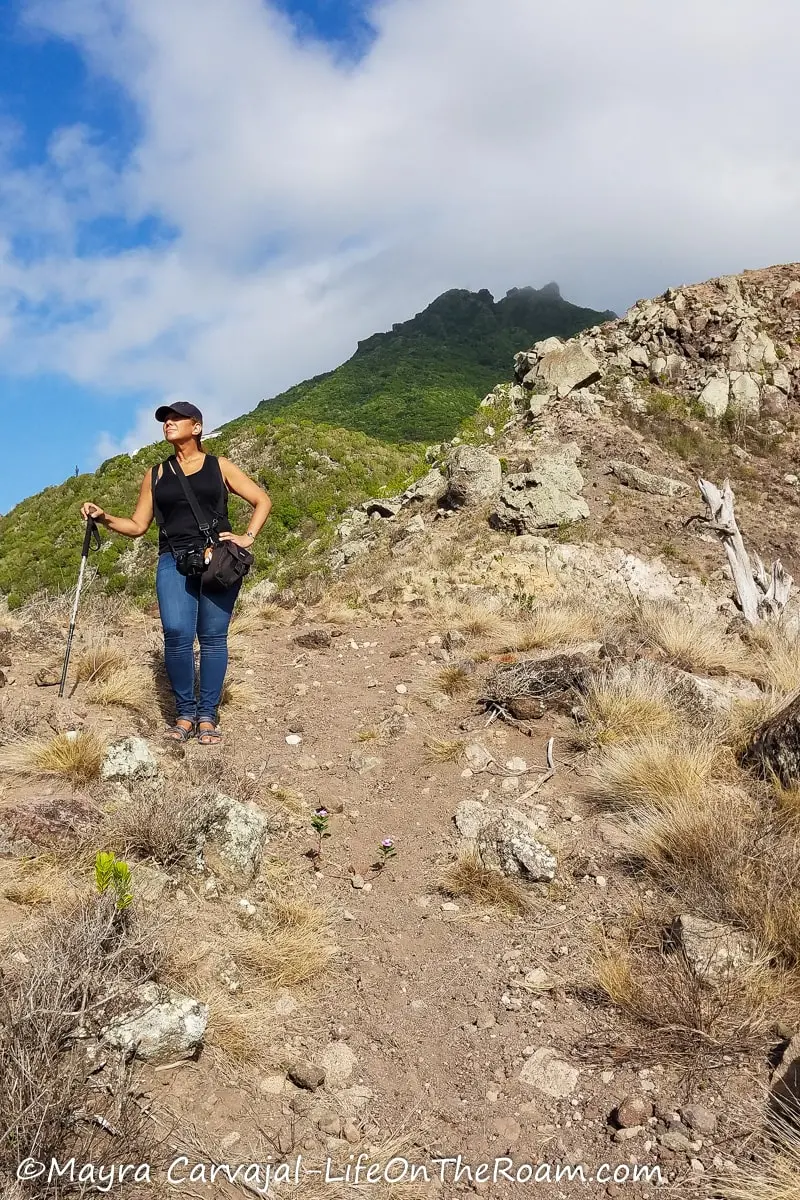
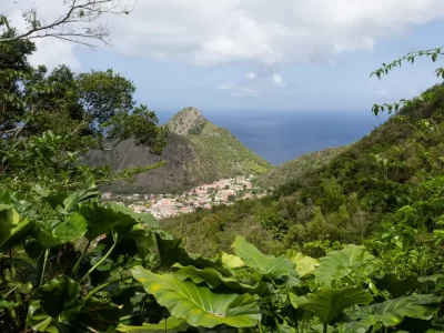
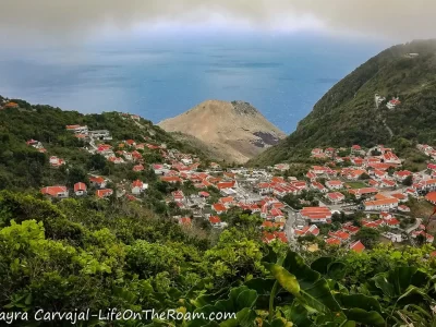
You’ll then scramble through the short rocky path that ends at a huge boulder from where you’ll enjoy one of the best views of Windwardside, with Old Booby Hill in the distance.


This is a good alternative if you can’t make it all the way up to Mount Scenery. For an even shorter access, you can make your way down here from the end of Mountain Road.
Distance: 0.48 kms/0.30 miles
Estimated time: 20 minutes one way (shorter if you access from the end of Mountain Road).
HIKING TRAILS ON SABA WITH HIKING DIFFICULTY: MODERATE
Bottom Mountain Trail

We started hiking the Bottom Mountain trail from the trailhead located near the Queen’s Gardens Hotel on Troy Hill, north of The Bottom. From there, we connected to Crispeen Track and ended up at the end of Mountain Road.
The first section was the most challenging (and fun) as the ascent is quite steep and I had to pull myself up using the on-site ropes and hanging on to roots and thick branches.

As you follow the yellow markers, turn around from time to time to enjoy panoramic views of The Bottom.
We went from a secondary forest to a rainforest walking past Heliconias, Elephant Ears, ferns, palms and banana trees.


Some sections of the Bottom Mountain trail go through farm lands.
Distance: 1.1 kms/0.68 miles
Estimated time: 1.5 hours one way
Crispeen Track

We accessed Crispeen Track from the end of Mountain Road, but you can also access it from the Mount Scenery steps about 20 minutes on your way up from Windwardside. As you hike down towards The Bottom, where the trail ends, you’ll hike from a secondary forest to a dry forest.
At some point you’ll see remains of the old steps and stone walls marking the path Sabans used for travelling between the villages. This trail offers a great viewpoint of The Road with St. Eustatius in the distance, and of St. John’s and The Bottom.

Crispeen Track connects with the Tara Ground trail, the Bud’s Mountain trail and the Bottom Mountain trail, which you could all do easily in one hike.
Distance: 0.91 kms/0.56 miles
Estimated time: 1 hour
Bud’s Mountain Trail

Bud’s Mountain trail connects the Mount Scenery trail with Crispeen Track, taking you through a secondary rainforest. The second time we went up Mount Scenery we took this trail on our way down (access is across the first shelter on your descent) to give our knees a break and then turned left at Crispeen Track.
The upper section is beautiful and lush, as if you would be in elephant ear land adorned with Lobsterclaws. It’s also muddy as you’re still surrounded by clouds. As you go down, you’ll find some openings and open fields with ocean views.


Distance: 1.47 kms/0.91 miles
Estimated time: 1.5 hours (starting at Crispeen Track)
Tara’s Ground Trail (Easy to Moderate)

Of all these short interconnected paths, Tara’s Ground Trail is my favourite. It’s a beautiful hike through a mature secondary forest that connects the Bottom Mountain trail (a rainforest environment) to Crispeen Track (a dry forest).
Follow the orange marks as you balance on big rocks, under a canopy formed by mature trees with long hanging vines. Remains of abandoned farms gave me a “tropical forest with ancient ruins” kind of vibe.

Distance: 0.69 kms/0.43 miles
Estimated time: 45 minutes one way from the junction with the other trails
Sulfur Mine Trail

The Sulfur Mine trail is an excellent location for bird watching if you want to spot seabirds. It also offers a view of Saba’s famous airport runway and the waves crashing against Green Island (more like Green Rock) – a breeding ground for several species during late spring- and The Pirate Cliffs, where birds hang out.
If you access the Sulfur Mine trail from the end of the side road off Airport Road (on Lower’s Hell Gate) you’ll go down a narrow path through a dry forest before you reach a big grassy meadow and a killer view. I only saw grass on my second visit, though. The first time I hiked this trail there was a severe drought and the grass was gone, leaving only rocks.


Like many hiking trails on Saba, the Sulfur Mine comes with a dose of history.
This is the location of the McNish Sulfur Mine, an abandoned mine from the 19th century that may be explored at times with a Saba Conservation Foundation certified guide. Check at the Trail Shop if this option is available when you visit as the temperature and humidity inside the mine, in addition to the fumes, can be suffocating.

Years ago a group of tourists got lost inside and stumbled upon the mummified body of another tourist who died exploring the mine on his own a year before. Don’t risk it.
What you can see is the remains of the old sulfur oven near the cliff.

You can access the Sulfur Mine trail from the road that connects Upper Hell’s Gate (Zion’s Hill) with the airport. From Lower Hell’s Gate, take the second left after you drive past the Queen of the Holy Rosary Church. The trailhead is at the end of the road.
You can also access the trail by turning right at the end of the All Too Far trail, which springs from the Sandy Cruz trail (will take you way longer).
Distance: 0.51 kms/0.32 miles
Estimated time: 40 minutes one way
The Ladder

The extraordinary sunset view from The Ladder is one of the main features of this trail, which is, as you can expect from its name, all steps. 800 of them.


But it’s not all sunset and pretty views of Great Hill. The Ladder is an important piece of Saba’s history.
Before Fort Bay, The Road, and donkeys, porters had to carry all the goods shipped to the island from Ladder Bay, step by step, up to the Customs’ House located at the top.
And before the ladder, stuff had to be carried uphill on a steep dirt path.
After I made it all the way down, scrambling over the broken steps at the bottom to see the waves crashing, I tried to imagine how challenging it must have been to unload a ship in this rocky coastline a century ago.
On my way up, as I started to feel the burn in my legs, I couldn’t imagine doing this carrying boxes of food and clothing, furniture, and even pianos. Suddenly, the burn didn’t feel that bad.

The Ladder is another good point for birdwatching, where you can spot seabirds passing by, brown-throated parakeets flying around mahogany and cinnamon trees and gorgeous Poinciana trees. You may even see red-tailed hawks.
Access to The Ladder is at The Bottom, driving past the Hospital towards Well’s Bay. Go left at the fork and within a few feet down the road you’ll see the sign for the trail on the left.
Distance: 0.43 kms/0.27 miles
Estimated time: 1 hour round trip
Bonus tip: if you visit Saba during a festival you may be able to participate in guided hikes as part of the scheduled activities. Otherwise, guided hikes are available throughout the year with SCF certified guide, James “Crocodile” Johnson. You can contact the Saba Conservation Foundation at +599.416.3295, or you can visit the Trail Shop.
HIKING TRAILS ON SABA WITH HIKING DIFFICULTY: MODERATE TO STRENUOUS
Sandy Cruz Trail

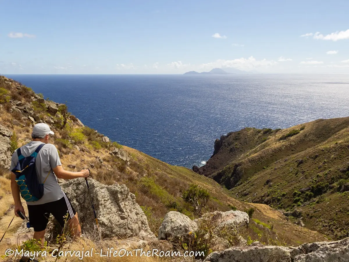
The scenic views of the north coast of Saba and the beauty of the rainforest made Sandy Cruz my favourite trail, neck to neck with the Elfin Forest trail.
Walls of elephant ears, long vines, and a tightly knitted tree canopy with tree ferns that look like green fireworks made me feel like I was on a wild expedition.

We started the hike from the trailhead located at the end of the higher road in Upper Hell’s Gate (Zion’s Hill) and finished in Troy Hill.
When you enter the rainforest you step into a narrow path that hugs the fern-covered hill on your left and a steep slope on your right. It’s green everywhere, with moss covering the rocks on the ground, making it slippery.

Soon you’ll enjoy the ocean views, with a glimpse of Saba’s airport, and the silhouette of Sint Maarten in the distance. Stop at the Scott E. Keatly bench and pinch yourself. Yes, you’re in paradise.

We kept ascending and descending along the Mountain Cabbage forest until I saw a hermit crab. How the heck this little guy climbed 550 metres is something I can’t comprehend. That’s what I call determination.


Delight on the heliconias, Eucharis lilies, and Star of Bethlehem on the side of the trail and look up at the epiphytes in search of Eyelash and Christmas orchids.


Around the middle of the hike you’ll walk through a banana plantation (it’s private land so the bananas should stay on the trees) before entering a secondary rainforest that goes through abandoned farms.


Once you reach Carla’s bench, from where you’ll see Torrens Point, you’re on the last leg of the hike.

From Troy Hill you’ll have a panoramic view of The Bottom, framed by Thai’s Hill and Parish Hill.
Hiking sticks will make your life easier as some sections are muddy and steep.
Distance: 2.86 kms/1.78 miles
Estimated time: 2.5 hours one way (add 30 minutes if you access from Troy Hill)
Parish Hill Trail

The Parish Hill trail circles a volcanic dome covered in dry tropical forest from where you’ll see The Bottom and pockets of sea views facing south and west.
You’ll gain most of the elevation during the first section, which is mainly loose rock showing signs of erosion. As you go up and you pass the big rocks the terrain is a little bit more compact and the path is flanked by trees, cacti, aloe plants and (I think) bromeliads.


Look back to enjoy the sea view framed by the hills.

We followed the map and started doing the inner loop of Parish Hill, but halfway we had to retrace our steps. We reached a point where the trail seemed to disappear and there were no marks. Maybe erosion or a recent storm washed it away (it may be clear by the time you do this hike).
Back to the main trail, we walked to the more dense part of the forest and checked the views of the road along the coast that leads to Well’s Bay and enjoyed a bird’s eye view of the capital of Saba.


We started descending and towards the last section, close to the hospital, we couldn’t find the trail. We had to make our way under the trees to get to the hospital’s parking lot. Nothing major.
The trailhead for Parish Hill trail is at the beginning of the road that leads to Fort Bay (on your right) and finishes at the road behind the hospital.
Distance: 1.01 kms/0.63 miles
Estimated time: 1.5 hours
HIKING TRAILS ON SABA WITH HIKING DIFFICULTY: STRENUOUS
Mount Scenery Trail

Mount Scenery is the most visited trail on Saba and it’s a popular choice for people who visit the island for one day from Sint Maarten. Here’s why:
First, when you reach the summit – at 887 metres (2,877 ft.) – you can claim that you’ve been to the highest point in the Kingdom of the Netherlands, which comes with breathtaking views. But there’s a catch, keep reading.
Second, the trailhead is conveniently located in Windwardside, the village where you’ll find most stores, restaurants and places to stay on Saba. It’s only a few steps from the Trail Shop run by the Saba Conservation Foundation.
And third, the trail is mainly stairs so most people can do it. The trick? We’re talking about 1,015 steps.
From the trailhead up to when you approach the Mas’Cohone’s Hill turn, the uneven steps are made out of rocks covered in moss.

You’re entering a lush rainforest so when it rains, it’s muddy and slippery, even the day after. Not a good option for a rainy day. The last section at the top is always slippery.
After you walk past the Mas’Cohone’s Hill sign you’ll step on a flat dirt path crossing a grassy field until you reach a fork. To the left you’ll find access to Crispeen Track and other interconnected trails, and to the right you’ll continue your ascent to Mount Scenery.
From now on it’s all uphill on steps of all sizes and inclinations (handrails come handy in the most slanted sections), with ferns, heliconias, mountain fuchsia, palms, treeferns, fruit trees and more along the way. You’ll find two shelters where you can take a break.
As you reach higher elevation, you’ll start seeing the blue horizon on your left. Stop, look back, and take pleasure in these appetizers since you may not have a main course waiting for you at the top. More on that later.


Once you see a bench on your left facing a “Scenic View sign” you can take a deep breath, you’ve almost made it.
Turn left at the fork, behind the bench, and go on the steps to visit the The Bottom viewpoint, from where you’ll see Torrens Point on the northwest coast. Go back and turn right to step into the magical world of the Mount Scenery upper valley, home to the cloud (elfin) forest.
This section has a sloped path so slippery that you’ll feel as if your shoes have turned into skates. You don’t walk, you slide, which is a reason why flip flops aren’t recommended (I did fine with sport sandals). Thank God for the handrails.

You’ll also see an entrance to the Elfin Forest trail. I think it’s better to access this trail from the Sandy Cruz trail and make your way up to Mount Scenery as the path is muddy and slippery. I can’t imagine doing it downhill.
On your left the landscape matches the set of a movie about the prehistoric era, with birds chanting at the top of their tiny lungs. It’s even more impressive when you see it from above, after climbing the rocky section ahead.


You’ll then walk on a flat dirt path from where you can access the two highest viewpoints on Saba.
To your right is the Windwardside viewpoint. Walk past the communication tower to find a narrow passage that ends at a big rock with a sign welcoming you to the highest point in the Dutch Kingdom. Congrats, you made it!
Windwardside is at your feet, with St. Eustatius and St. Kitts and Nevis in the background.

The views of the ocean and Saba’s rugged topography with its cliffs and valleys are totally worth the 1,000+ steps. However, they’re elusive.
Remember I told you to look back as you go up? That’s because it’s all the views you may see. Most times, there’s a cloud up there (hence the name “cloud forest”), which you’ll find in most pictures of Saba.
You may look up before and during your hike and see a clear peak, and by the time you get there it’s cloudy. My first two attempts, this was the view.


But the third time’s the charm. The gods of all things misty parted the clouds. Yay!
Retrace your steps and go to the other side of the fork to the Hell’s Gate viewpoint. You’ll find a boardwalk with steps leading to spectacular views of the cloud forest at the top, Spring Bay, Old Booby Hill, and the airport.


The hike is beautiful, even if you’re surrounded by clouds when you make it to the top. But if your only goal is to take a clear picture from there, you may be disappointed. As a general rule, you’ll find more clouds later in the day.
You can also access the Mount Scenery trail from the end of Mountain Road. Park your car or ask a taxi to drop you off and step on the trail from there, which will save you about 20 minutes of steps.
If you’re up for a bigger challenge, you can access Mount Scenery from The Bottom by hiking the Crispeen Track trail all the way or by connecting to the Bud’s Mountain trail via Crispeen Track.
Save your knees and bring a hiking stick. Be aware that there’s no phone signal in some sections so stay safe and share your hiking itinerary with someone before you leave.
Distance: 2.39 kms/1.49 miles
Estimated time: 2.5 hours round trip (shorter if you take the shortcut at the end of Mountain Road)
Elfin Forest Trail

Does the fairytale name sound so magical to you as it sounds to me? On Saba, I learned that Elfin Forest refers to the type of vegetation that you find at high elevations in a tropical environment with wet conditions. Basically, a cloud forest.
We accessed the Elfin Forest trail via the Sandy Cruz trail from Zion’s Hill. The trailhead sign is about 350 metres from Sandy Cruz’s entrance. If you see a bench go back, you’ve gone too far.
During the ascent you’ll be under shade of tree ferns, Elephant Ears and Mountain Cabbage, with occasional views of the upper section of Mount Scenery in the distance, where it ends.


Before reaching the top section of the cloud forest stop at the Mariette Naber bench from where you’ll have a panoramic view of Northeast Saba, the airport, and the island of Sint Maarten.

Shortly after we saw nothing but the thick, lush, evergreen, cloud forest. The trail became muddy and slippery, and some sections were overgrown. My feet slid in every direction on the thick mud as I tried to keep my balance through rocks and slopes. Thank God for the hiking poles.

The top section is populated by Mountain Mahogany and giant banana trees wrapped in a mist. You’ll see epiphytes, moss, and tiny leaves wrapping the trees, long vines hanging from the branches and you may spot some orchids. It’s such a mystical environment that if I had seen red and gold fairies fluttering around me I wouldn’t have thought I was losing it.


Our original plan was to return the same way and take the trail down back to Sandy Cruz. That didn’t stick. “I’m so NOT going back this way!”.
We took the Mount Scenery steps down to the start of Mountain Road, which ends at The Road, near English Quarter (the East end of Windwardside). The downhill walk along Mountain Road has fabulous views of Windwardside and the sea beyond.
Alternatively, you can take the steps all the way down to the Mount Scenery trailhead.
As you may have figured out by now, the difficulty of this trail comes in the form of a pool of mud as you gain more elevation along the steep upper section. I did this trail during my first visit to Saba when there was a drought going on, and it was still a mud pool. I can’t imagine the conditions during the rainy season.
I wouldn’t do this trial without hiking poles and, if possible, bring hiking boots. It’s messy, but I wouldn’t miss it.
Distance: 0.89kms/0.55 miles
Estimated time: 1 hour
All Too Far Trail

Yes, Saba has funny names and I can only guess that, back in time when the trails were the “roads”, people didn’t come here often because it was, ahem, all too far.
The All Too Far trail spurs from the Sandy Cruz trail and leads to the Old Sulfur Mine trail, or viceversa.
I took it from Sandy Cruz, downhill and then back up. The terrain is rocky, slippery and steep, with many switchbacks that take you from a rainforest environment to a dry scrub vegetation ecosystem. Keep your eyes peeled for orchids.

As you approach the lower section you start losing the shade and it gets drier and hotter (bring enough water), but the sea views get better. You’ll see the ocean beyond the north coast and at the junction with the Sulfur Mine trail you’ll see the top of the Pirate Cliffs.

This sweet memory softens the memory of the pain I felt after being stung twice by a Jack Spaniard wasp near the trailhead. Instead of leaving a sting mark on my hand, it left a small hole, as in a bite. And it’s freaking painful.
There’s no phone signal here.
Distance: 1.5 kms/0.93 miles
Estimated time: 1.5 hours one way (starting at the junction with Sandy Cruz), 2.5 hours one way (starting at the junction with Old Sulfur Mine).
Giles Quarter Trail

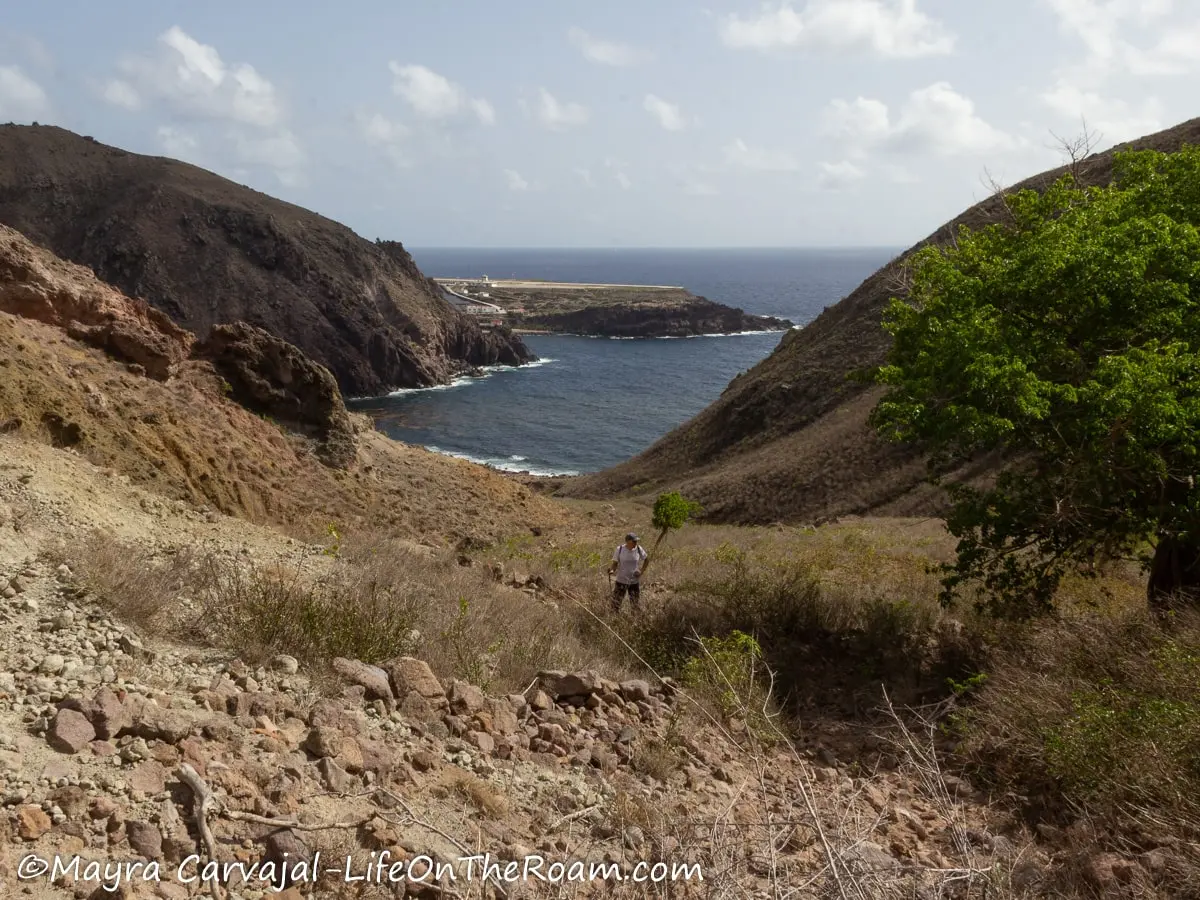
The Giles Quarter trail offers uninterrupted views of the southern coast of Saba from its access point through the Dancing Place trail, off The Road, and it ends at Fort Bay. On a clear day you can also see St. Eustatius.
The first section will take you along a ridge with orange marks indicating the route until you get close to the coast.

After that you kind of wing it, although it’s not that difficult as you follow the coastline towards Fort Bay.

The government is building a new road in the area close to the trail therefore there may be detours (or even closures) as you approach the coast. Before doing this trail check with the Trail Shop that there are no washouts due to recent storms.
Before heading to Fort Bay you can turn left and walk along the coastline towards the Hole in the Corner well.
The main feature of the Giles Quarter trail is the sea view. And then the views of the cliffs and the road when you look back. Other than cacti, dry scrub vegetation, and some flowers like the Wild Allamanda and Mountain Mana, you won’t see anything else than rocks.


You’ll also see the poisonous Manchineel tree, which has fruits resembling a small apple. You can’t seek cover under these trees. There are warning signs next to them, but in case they’re missing, be aware that they’re around and stay away (read more on the Safety Tips section).
There’s no shade whatsoever, which is what makes this trail difficult. Bring a hat, sunglasses, reef-safe sunblock, and enough water. Start early as if it gets too hot the lower section turns into a heat trap.
Wear long pants to protect you from scratches and a hiking stick to save your knees.
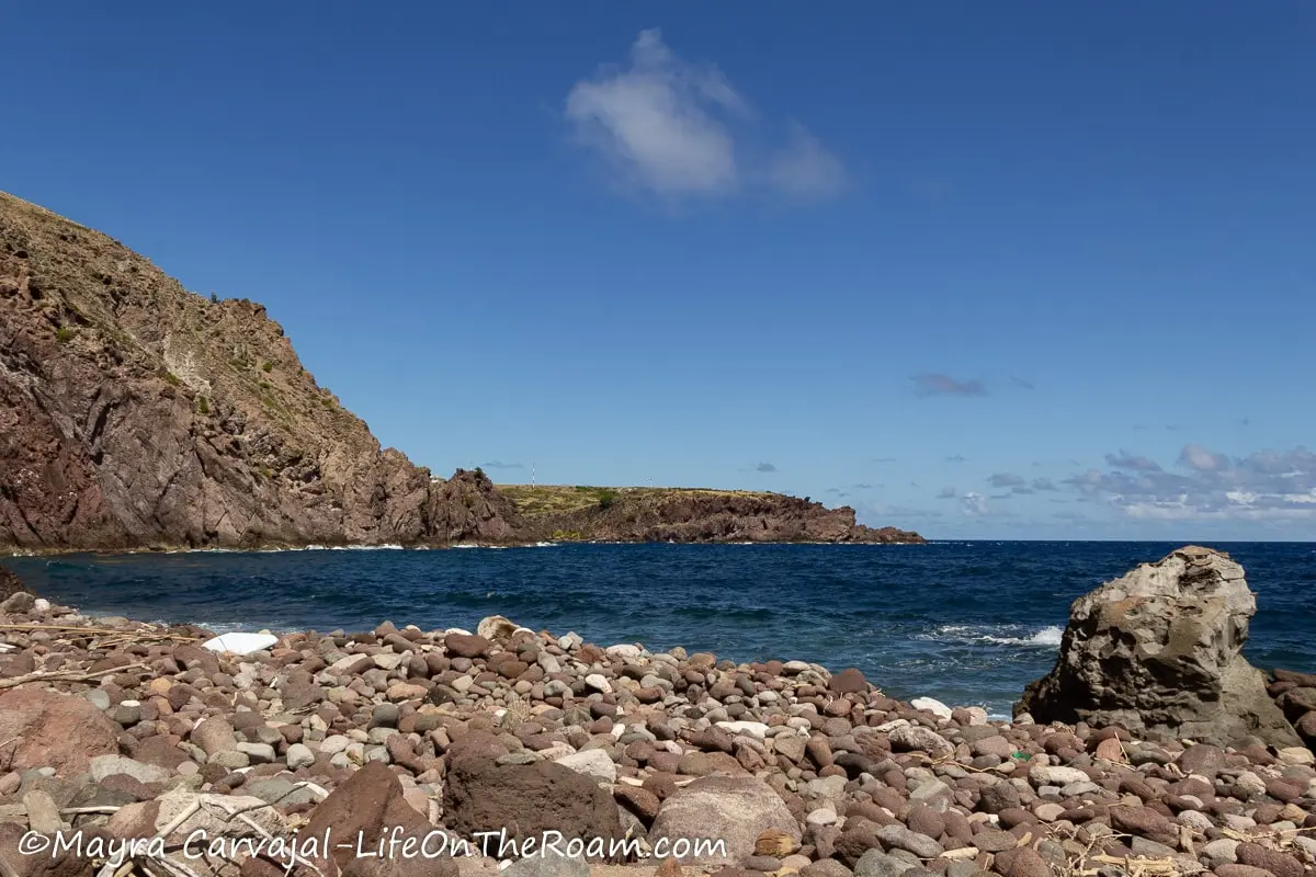
Right before reaching Fort Bay you can take a refreshing dip at Gary’s Pond, a man-made pond to swim and snorkel. You can arrange a taxi to pick you up at Fort Bay as they’re not always available.
Distance: 3.49 kms/2.17 miles
Estimated time: 3 hours (downhill from Dancing Place)
Mary’s Point Trail

Mary’s Point trail is an interesting one that combines scenery and archaeology. It takes you through the hills of Saba’s northwest coast where you can see the remains of Mary’s Point village (founded in the early 19th century) in addition to fabulous views of Well’s Bay.
The trail starts right before reaching the end of the road to Well’s Bay and continues alongside a ravine until you make a left to start ascending through a shaded path in the forest.


At a higher elevation wood posts with ropes and steps cut in the ground ease the ascent. At this point the ocean views start peeking through the sea grape trees.

You’ll then emerge from the forest to an open area at the edge of the cliff where you’ll find a bench and a viewpoint of Well’s Bay, Torrens Point, and the north coast.


If you could jump into a time machine and head back to the 19th century you would be seeing pirate ships and privateers instead of dive boats. According to the Saba Archaeological Centre, captured boats were brought here, where the people from Mary’s Point would change them and make them unrecognizable so merchants from Statia could resell them in St. Thomas under disguise.
If you could go further back in the time machine you would see indigenous peoples hunting and living in caves.
Keep ascending along the edge of the mountain and visit the stone foundations and cisterns of Mary’s Point village, where the main activities were fishing, offering supplies to boats, farming, and laundering the cargo of captured ships.
There’s a map of the village showing the location of the cistern and of 12 out the 16 houses built here before Sabans tackled the monumental task of deconstructing them (except for the stone foundations) and rebuilding them at The Bottom in the early 1930s.


The reason? Poverty was on the rise, public health was declining, and constant erosion was a danger. The erosion continues and at some point all this may disappear, which is why it’s important to stay away from the cliff and it’s advisable to bring a hiking partner.
I wouldn’t attempt this hike if it’s raining or the day after. Not only the leaves covering the steps can make the descent tricky, but you may also have to deal with falling rocks. Every time the wind picked up I could hear small rocks falling and feel lots of dust in the air, forcing me to close my eyes. Bring sunglasses.
You’ll need a car or take a taxi to Well’s Bay and arrange a pick up time as there’s no phone signal here.
If the sea is calm you may be able to snorkel on Well’s Bay after your hike.
Distance: 0.75 kms/0.47 miles
Estimated time: 1 hour one way
Spring Bay Heritage Trail

The “heritage” part of the name comes from the artifacts found along this trail, belonging to the indigenous peoples who inhabited this area before colonization. You can see them at the Harry L. Johnson Museum.
From English Quarter (right east of Windwardside), the Spring Bay trail starts as a dry forest with many trees carrying epiphytes (you may see some daddy long-legs orchids), along a rocky path with elephant ears, bromeliads, aloe plants, and hermit crabs patrolling the grounds.

This is the only shaded section of the trail. You’ll then walk downhill on a ridge with some colourful spots courtesy of Turk’s Cap cacti, periwinkles, and Wild Allamandas. Look back to catch a good view of Mount Scenery, clouds permitting, and the cliffs of Saba.

To the right you’ll see beautiful views of Old Booby Hill and St. Eustatius in the distance. To the left lies Spring Bay and the airport.
Up to the point where I was facing the hill I enjoyed a calm breeze, which immediately stopped once I turned left at the trail sign to go down towards Spring Bay.

This marks the start of what, to me, is the most challenging section of the trail: from the left turn at Old Booby Hill until you start climbing up to Kelbey’s Ridge.
It’s freaking hot, there’s no air and no shade. It’s all dry scrub vegetation and you can’t go anywhere near the only tree that provides shade, a Manchineel tree, because it’s poisonous.
In the ravine the terrain is loose rock, gravel, and the erosion has eaten parts of the narrow trail.
Once you arrive at the bay you’ll balance over medium and large boulders, walking parallel to the coast and then turn left, following the markers to go uphill.

The sea will be on your right, along with an unbelievable amount of plastic washed out on the rocks, possibly mixed with some sargassum (no swimming here). Despite cleaning efforts, more and more plastic keeps coming. I can almost hear the ocean saying: “There you go. You all take back what you threw at me”.
Follow the orange markers on the rocks and look for the Kelbey’s Ridge sign. Inland, not that far, lay the ruins of the Spring Bay boiling house (which I noticed once I started going uphill). I’ve done this trail twice and I haven’t seen them up close because at this point I just want to get out of the hot pan to feel some air again, which happens as soon as you start going up the hill to reach Kelbey’s Ridge.
I don’t think there’s much to see, anyway. You be the judge:

We took some breaks along the ascent to have a snack and delight in the lovely view of the Spring Bay valley and Old Booby Hill. Once we reached the top we walked towards a bench that is one of the best observation points of Saba’s airport.


From here you can step on the paved road that connects to Airport Road, walk downhill towards the airport and call a taxi. Or you can hike back to English Quarter, in which case my hat’s off to you 1000 times.
If you want to have a refreshing dip after hiking the Spring Bay trail you can walk a few minutes past the airport and visit Cove Bay. Calling it a beach is a little bit of a stretch, but it does the job to cool you down.
Bring tons of water for this hike, much more than what you think you’ll need. Of all the trails I completed on Saba, this was the hottest. Do it either early in the morning or early afternoon for some shade. Don’t forget sunblock, hat, sunglasses, and a hiking stick. You’ll kiss it at the end of the trail.
You’ll do much better with hiking shoes due to the loose rocks.
Distance: 2.96 kms/1.84 miles
Estimated time: 3 hours one way
Safety Tips for Hiking in Saba

- The Saba Conservation Foundation does a great job maintaining the trails and the markings. However, rough weather can change trail conditions in a heartbeat. Erosion and storms affect the island steep hills and downpours can make muddy trails impassable prompting closures and restrictions. Check the link under the “View the Latest SFC Trail Advisory” section on this page before planning your hikes. Before hitting the trails visit the Trail shop for maps and latest updates (not a guarantee that you won’t find unexpected conditions).
- Always let someone know your hiking itinerary as some trails have no phone signal.
- Manchineel trees, which you can find on some trails near the coastal areas, are poisonous. The fruit is known as “death apples”, which says it all. Not only the fruit is poisonous, but the sap of the tree and the water falling from its leaves when it rains are harmful. Although signs are displayed next to the trees, always check that you’re not approaching one.


- Hiking sticks on Saba are highly recommended. You’ll encounter slippery conditions, terrain with loose rocks, steps covered in leaves, and constant changes in elevation. Save your knees and your behind and rent them at the Trail shop or bring your own. Whistles are also available.
- I was able to get away with sport sandals for some trails (forget about flip flops), but you’ll be better off with hiking shoes and, in some cases, with hiking boots.
- If you encounter a Black Racer snake, let it be. It’s unique to Saba and Statia and it’s harmless.
- Bring plenty of water. The trails on the lower section barely have any shade (don’t forget your hat) and it gets hot. The trails on the upper section are shaded, but they are steep.
- You can encounter Jack Spaniard wasps on some trails (I got bitten twice and it hurts like hell). If you’re allergic, take precautions.
Have you done any hikes on Saba? Which was your favourite? For more hikes around the Caribbean check out my posts about hiking in Sint Maarten and the beautiful hikes on Nevis island.
YOU MAY ALSO WANT TO READ
BOOKING FLIGHTS AND ACCOMMODATIONS
To get from A to B without losing your shirt
Skyscanner: to find cheap flights. Get notified of price drops with the “Price Alert” feature or use “Search Everywhere” to see where you can go without breaking the bank.
Busbud: to book bus tickets everywhere.
To find a place to stay for less
Booking.com: this site combines everything under the sun. You’ll find hotels, apartments, B&B, hostels, rooms, etc., with all sort of filters to make your search a breeze.
Hotwire: the first site I check when we plan to stay at a hotel for a few nights. You can save anything from 20% to 60%. Use the search filter to find what you want and you’ll end up with three listings that match your criteria. You’ll know which one you’ll get after you book. If you can handle a little bit of uncertainty you can score big savings.
House Sitting: you take care of people’s pets and house for free while staying for free. It’s the closest thing to experiencing a place “like a local”. But it comes with responsibilities… Are you an animal lover? It may become your new way to travel.
To get travel insurance
SafetyWing: travel medical insurance that gives us peace of mind knowing that we’re covered in case of emergency. It’s convenient, affordable, and suitable for digital nomads who spend a long time outside their home country.
Check the full list of travel resources on my Resource Page for more options and savings